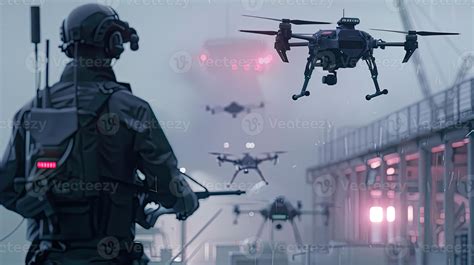
Police departments nationwide are deploying autonomous drones capable of launching from rooftops, flying beyond visual range, tracking vehicles, and transmitting live video directly to police command centers. Artificial intelligence increasingly analyzes these feeds, flags objects, and connects aerial surveillance with other police data.
Federal funding is accelerating the deployment of this technology while public oversight lags behind. The result is a policing network that monitors expansive areas from above, processes visual information at machine speed, and operates without the physical constraints that previously limited surveillance.
As of February 2026, over 1,000 law enforcement agencies secured Federal Aviation Administration waivers to operate autonomous surveillance drones under so-called “drone-as-first-responder” (DFR) programs. While waiver recipients include fire departments and first responders, the vast majority are police departments in cities across the country.
Police have used drones for years, but the new generation is fundamentally different: artificial intelligence now handles tasks once performed by human pilots. It navigates aircraft, avoids obstacles, follows targets, and moves from docking stations to incidents with minimal human intervention.
EFF researcher Beryl Lipton described this shift in a recent statement: “The human increasingly is not flying the drone; the drone is driven by artificial intelligence and just deployed from one spot to another spot.”
This automation dramatically expands surveillance capabilities. A single operator can supervise multiple drones while software manages most flight operations. AI is therefore not merely an addition to DFR programs—it enables persistent aerial surveillance at scale.
Flock Safety, a company best known for automated license plate readers (ALPRs), has aggressively entered this market with its DFR system. This fully remote solution automatically launches in response to 911 calls and provides real-time video within an average of 86 seconds, giving officers situational awareness before arrival. The system integrates with existing technologies like CAD and LPR, enabling rapid aerial responses without requiring rooftop personnel.
Flock’s Alpha drone can fly at 60 mph over a four-mile radius (covering approximately 50 square miles). It reads license plates from up to 2,000 feet away and carries thermal imaging and powerful zoom capabilities. According to the company, its drones reach emergency calls in an average of 86 seconds and arrive before officers in 78% of cases. They also resolve about one in five non-emergency calls without dispatching patrol units.
The business is expanding rapidly. In recent weeks, Flock’s CEO, Garrett Langley, stated that drones have become the company’s “fastest growing business,” with over 200 DFR customers nationwide.
A recent investigation revealed an unusually clear and chilling look at this aerial layer of surveillance. Security researchers Sam Curry and Maik Robert discovered live video from five San Francisco Police Department Skydio drones was exposed through a publicly accessible web link. The feed included color video, thermal imagery, GPS metadata, and information identifying police drone pilots.
The researchers archived roughly three hours of footage covering 20 flights over about 48 hours. This captured hundreds of people and vehicles during routine operations. One drone tracked a vehicle across the city and zoomed in on its license plate. Another hovered over a young person sitting alone on a rooftop. Other footage showed individuals inside or near apartment buildings, with one drone following two men until they parked to play basketball.
In real-time surveillance feeds, users can observe dozens of apartments, watch police zoom in on individuals, and even see arrests occurring. The fact that this data was exposed underscores significant privacy concerns.
The San Francisco Police Department stated the link was intended for law enforcement but was improperly accessed. Researchers confirmed no authentication bypass occurred because none was required. Police later tightened sharing controls.
Beyond cybersecurity risks, the leak demonstrated how extensively ordinary life can be captured during routine police operations. A camera sent after a suspect also records rooftops, windows, sidewalks, cars, courtyards, and bystanders. AI makes this data collection more impactful: humans cannot review thousands of hours of video in real time; machines can.
Some cities are beginning to resist the expansion. Nashville police launched a limited DFR trial in May, covering a two-mile radius with three drones from the Madison Precinct roof. Police credited it with locating suspects and resolving one missing infant case in August. However, the initiative sparked political controversy after officials learned it was initiated without a council vote or public hearing. The department ended the trial on August 7 as council members pushed legislation to close the loophole.
New Orleans faced an even sharper challenge. Activists discovered internal policy language that could have allowed police drones to carry weapons with approval from the police superintendent. Public pressure forced the department to abandon this language. On August 6, the city council adopted new reporting requirements for drone deployments, including timing and supervision details—though these rules primarily add transparency without broadly restricting use.
Once a city purchases hardware, installs launch stations, signs software contracts, and trains operators, surveillance becomes part of ordinary policing. Funding sources include wealthy private donors, police foundations, federal grants, and technology company partnerships that offer free trials and assist departments in pursuing regulatory waivers.
In June 2026, the Department of Justice launched a $300 million pilot program to test “whole-of-a-city” surveillance approaches across two to four cities nationwide. Eligible purchases include license-plate readers, AI systems, unmanned aircraft, counter-drone technology, and real-time crime centers.
Congress also recently appropriated an additional $500 million for state and local infrastructure to “detect, identify, track, or monitor” unmanned aircraft deemed threats. This could fund radio-frequency sensors, radar, and optical cameras that feed live airspace data into integrated command centers.
A small group of technology companies is building this surveillance ecosystem. Flock Safety entered the market after acquiring drone startup Aerodome in 2024. Skydio builds autonomous drones like the X10 with rooftop docks and has faced scrutiny over military deployments, including sending over 100 reconnaissance drones to Israel shortly after October 7 for use by the Israeli military in Gaza—a move described as “battle-tested” before expanding domestically. The company now reports “flying over American cities, surveilling protesters and automatically uploading millions of images to an evidence database.”
Axon, best known for Tasers and body cameras, offers a complete DFR solution combining Skydio aircraft with its evidence management systems, dispatch platforms, and real-time intelligence tools.
The industry’s trajectory is clear: the drone is only one component. The real product is an interconnected surveillance platform linking aircraft, cameras, license plate readers, dispatch records, AI analytics, and police databases in real time.